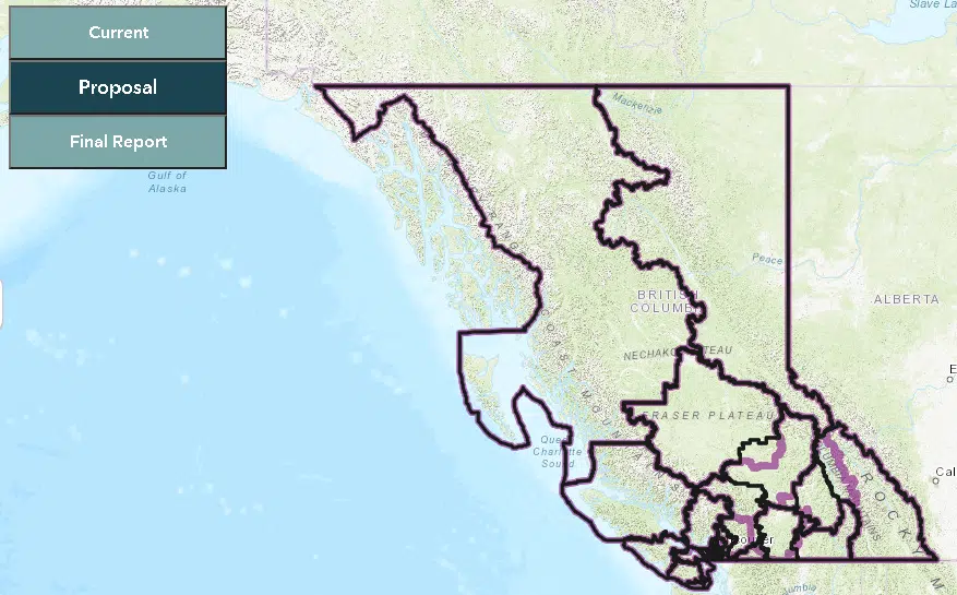
As the province continues final consultations on its provincial electoral boundaries, Ottawa has proposed a re-mapping of federal districts.
Currently, BC is divided in to 42 federal electoral districts, but with BC’s recent population spike, the Electoral Boundaries Commission is looking to add one more.
Their aim is to have each District cover 116,300 residents, with consideration given for community identity and interest, as well as historic and current geography.
Two of the North’s three federal ridings would see changes under the newly proposed map.
Under that proposal, the Skeena-Bulkley Valley District would remain the same, as it is already the largest District in the province.
However, the Cariboo-Prince George riding would be reconfigured to incorporate the North-central portion of the Kamloops-Thompson-Cariboo district.
Consultations will begin in June and continue through September, though only one will be in the North, in Prince George on June 22nd.
You can view the proposed map and all changes at this link.
REMEMBER: Provincial and Federal Electoral Boundaries are separate, for more on the on-going provincial consultations, visit this link.


Comments